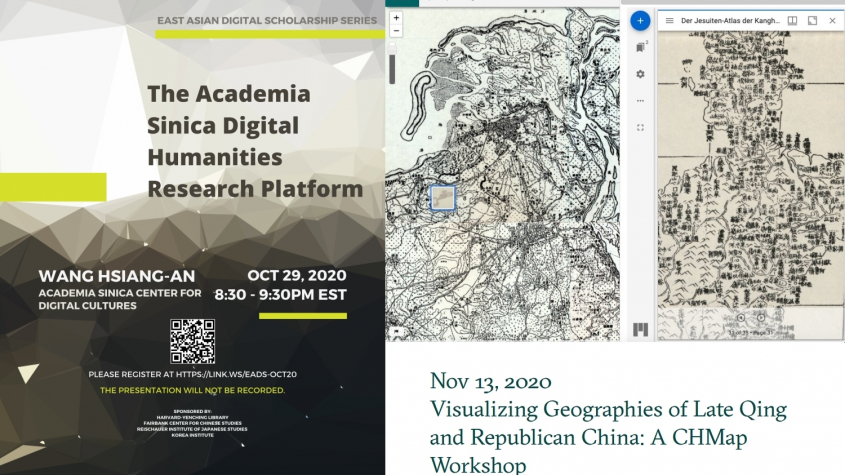
Ankündigung von zwei Veranstaltungen zum Arbeiten mit digitalen Texten sowie Karten und Geodaten
Liebe Leserinnen und Leser,
wir möchten gerne auf zwei interessante Veranstaltungen im Bereich der digitalen Geisteswissenschaften hinweisen, durchgeführt von der Harvard-Yenching Library sowie dem Max-Planck-Institut für Wissenschaftsgeschichte. Beide Veranstaltungen werden online durchgeführt, eine Registrierung ist notwendig:
The Academia Sinica Digital Humanities Research Platform
30 October 2020, 1:30 am – 2:45 am (Berlin Time) / 29 October 2020, 8:30 pm – 9:30 pm EST (USA and Kanada)
Speaker: Hsiang-an Wang (Academia Sinica Center for Digital Cultures)
Launched in October 2018, the Academia Sinica Digital Humanities Research Platform (https://idh.ascdc.sinica.edu.tw/member/) is an one-stop platform of source materials, digital tools, and collaboration that enables big data analysis for innovative research. Combining open access and crowd collaboration, it enables search, keyword tagging, statistical analysis, text comparison, etc. for over 47,000 Chinese digital texts (~7.6 billion words) from Academia Sinica, Kyoto University, and more. The English version of the platform was added in 2020, allowing big data analysis of English texts. In the October webinar of the East Asian Digital Scholarship series, Dr. Wang Hsiang-an will introduce the platform to us.
This presentation is part of the East Asian Digital Scholarship Series, organised by Harvard-Yenching Library.
More information and registration at:
Visualizing Geographies of Late Qing and Republican China: A CHMap Workshop
13 November 2020, 5:00 pm – 6:30 pm (Berlin Time)
Organisers: Nung-yao LIN, Qun Che, Shih-Pei Chen, Sean Wang
This workshop – organised by Department III, Max Planck Institute for the History of Sciences (MPIWG) – will introduce CHMap, an open-access web GIS platform developed by MPIWG and Shanghai Jiao Tong University (SJTU), to researchers in Chinese and East Asian history and digital humanities. CHMap provides large-scale, geo-referenced land survey maps of China produced in the late nineteenth and early twentieth centuries as base layers via Web Map Tile Service (WMTS). It allows researchers to integrate image collections from other sources on top of those base layers for exploratory and comparative analyses.
More information and registration at:


 CC BY-NC-SA 3.0
 SBB-PK